
West Endpoint:
East Endpoint:
Counties Passed through: Sherman, Thomas, Sheridan, Graham, Rooks, Osborne, Mitchell, Cloud, Clay, Riley, Pottawatomie, Shawnee, Jefferson, Douglas, Levenworth, Wyandotte
History
Photos
Clicking on a photograph takes you to the photo's flickr page
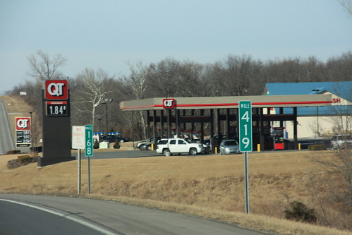
Dual mileposts north of Bonner Springs: K-7 mile marker 168 is also US 24 mile marker 419. 14 February 2009
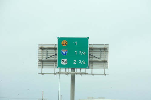
On I-635 south of the K-32 interchange, the next three exits are K-32, I-70, and State Avenue. This sign was subsequently replaced as part of the removal of US 24 from State Avenue. 10 March 2009
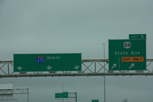
Here's an example of an optional lane. The far right hand lane has an "EXIT ONLY" panel, with a vertical line separating it from the "optional lane" that can either exit or continue on 635. This sign was replaced with a new one that removes the US 24 designation. The new State Ave. sign was photographed in Late May, 2009. 10 March 2009
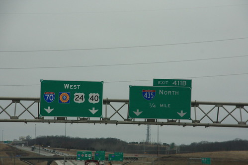
A new guide sign has been added to I-70 that features the addition of US 24 and US 40 to I-70 at I-435. 10 March 2009
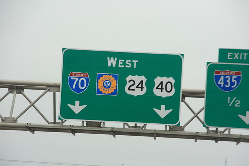
Here's a closeup of the new guide signs on I-70/US 24/US 40 at I-435. The Turnpike logo used on the sign is a 16-petal variant, the same shield shape as the modern Kansas Highway sign. 10 March 2009