
West Endpoint:
East Endpoint:
Counties Passed through: Sherman, Thomas, Sheridan, Graham, Rooks, Osborne, Mitchell, Cloud, Clay, Riley, Pottawatomie, Shawnee, Jefferson, Douglas, Levenworth, Wyandotte
History
Photos
Clicking on a photograph takes you to the photo's flickr page

The optional lane sign on 110th Street at I-70/ with the new guide sign that includes US 24/40, in the "normal" configuration. During race weekends at Kansas Speedway, the optional lane is designated for exiting traffic only. 10 March 2009
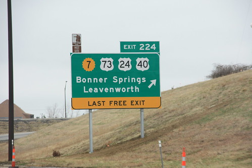
The new advance sign for the K-7 Bonner Springs exit on I-70. The new sign includes US 73 and the re-routed US 24/40. 10 March 2009
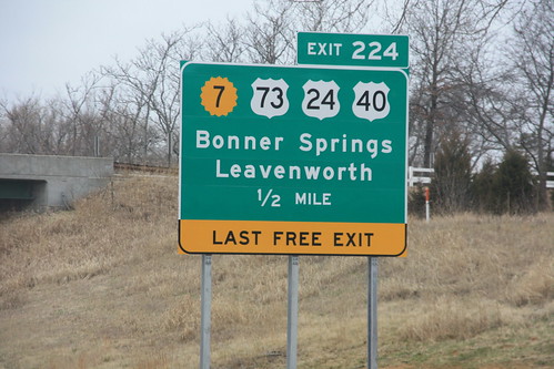
Here's the final sign for the K-7/US 24/40/73 Bonner Springs interchange on I-70. The "Last Free Exit" sign, which was tacked on the old sign with a supplemental sign, features a little more prominently here. 10 March 2009
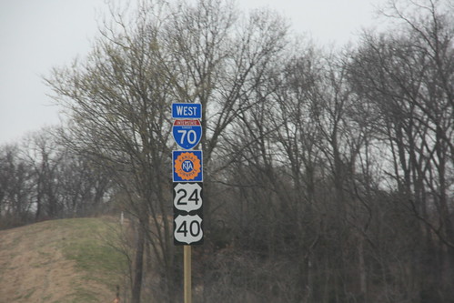
The new Turnpike logo signs have arrived and the old signs have been pulled on I-70/US 24/US 40 in Kansas City. The new turnpike emblems have a 16-petal shield. 1 April 2009
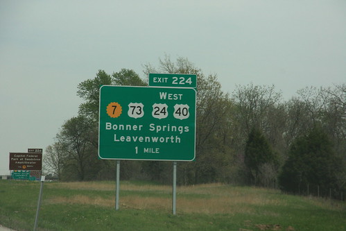
Here's the new eastbound sign for the Bonner Springs interchange on I-70 at K-7, showing the new alignment of US 24-40 and the new south end of US 73. 28 April 2009