
Length: 427.138 miles
West Endpoint:
East Endpoint:
Counties Passed through: Wallace, Logan, Gove, Trego, Ellis, Russell, Lincoln, Ellsworth, Saline, Dickinson, Geary, Riley, Pottawatomie, Wabaunsee, Shawnee, Douglas, Leavenworth, Wyandotte
Full Description
History
Junction Guide
Photos
Clicking on a photograph takes you to the photo's flickr page
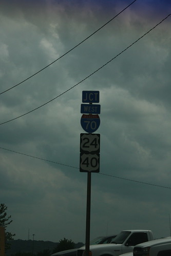
The interchange between I-70/US 24/US 40 and the 7th Street trafficway is an incomplete one. There is no access from southbound 7th/US 69 to eastbound I-70, as this sign indicates, nor is there access from westbound I-70 to northbound 7th. 26 May 2013
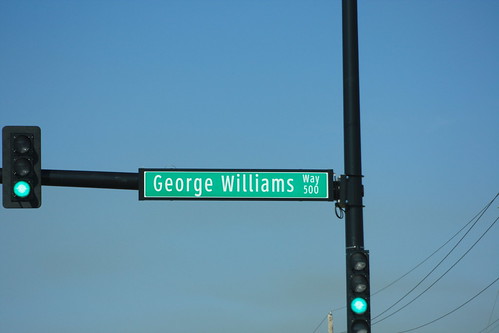
The new signals on 6th Street (US 40) and George Williams Way in Lawrence utilize the Clearview typeface. 5 April 2014
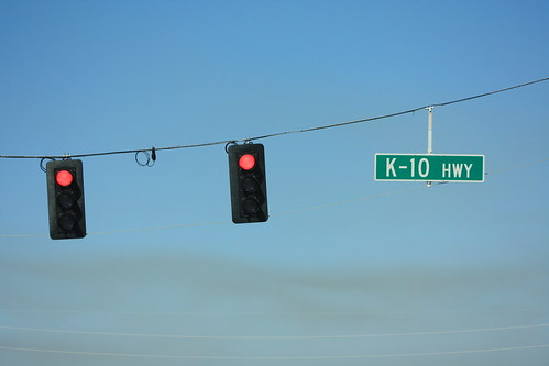
The new traffic signals for 6th Street (US 40) at K-10 are mounted on wire spans instead of metal poles. 5 April 2014
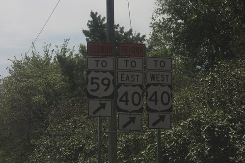
A major reconstruction of the 6th and Iowa intersection in Lawrence has changed access patters for traffic coming off of the Turnpike. All traffic must take Rockledge Road to get to 6th or Iowa. This assembly has been modified by having the "straight ahead" arrows replaced with "exit right" arrows. Since Rockledge is the designated route for traffic from the Turnpike to westbound 6th Street, there is no detour sign above the "To West 40" assembly. 19 May 2014
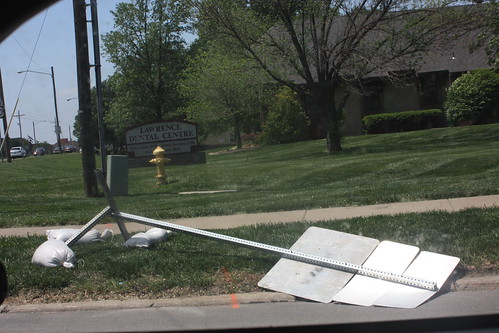
You had one job! It's the first day of a major project around the 6th and Iowa intersection in Lawrence, and already, a detour sign has fallen flat. 19 May 2014