
Length: 427.138 miles
West Endpoint:
East Endpoint:
Counties Passed through: Wallace, Logan, Gove, Trego, Ellis, Russell, Lincoln, Ellsworth, Saline, Dickinson, Geary, Riley, Pottawatomie, Wabaunsee, Shawnee, Douglas, Leavenworth, Wyandotte
Full Description
History
Junction Guide
Photos
Clicking on a photograph takes you to the photo's flickr page
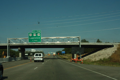
The first gantry advising the East Lawrence Exit on the Kansas Turnpike is posted in front of the Michigan Street overpass, just after the West Lawrence exit. A I-70 was subsequently posted on the right-hand gantry post. The east Lawrence exit is signed as US 40, US 59, and US 24. 17 August 2011
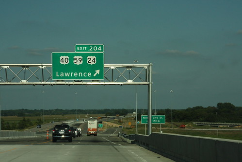
Here is the final exit gantry for the East Lawrence exit on the on the Kansas Turnpike for US 24 US 40 and US 59. Note the ground mounted supplemental guide sign posted right behind the gantry. 17 August 2011
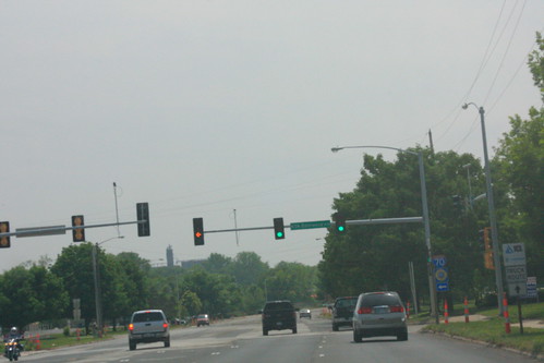
The traffic signal at North 3rd (US 40/59) and the Kansas Turnpike (I-70) in North Lawrence has received a facelift. The left turn signal has been changed from a five-aspect "doghouse" signal to a flashing yellow arrow. 28 April 2012
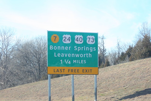
One of the approach signs for the I-70/Kansas Turnpike Bonner Springs exit got damaged and had to be replaced. The replacement sign uses the Clearview typeface, and the K-7 shield is the 20-petal variant generally used only by the KTA. 22 December 2012
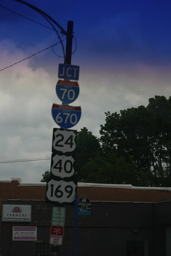
Here we have *five* markers on this junction assembly. In close order, Central Avenue intersects with both I-70 and I-670. In addition, I-70 carries US 24, US 40, and US 169 along this stretch. 26 May 2013