
Length: 454.9 miles
West Endpoint:
East Endpoint:
Counties Passed through: Hamilton, Kearney, Finney, Gray, Ford, Kiowa, Pratt, Kingman, Sedgwick, Butler, Greenwood, Wilson, Neosho, Montgomery, Labette, Cherokee
Photos
Clicking on a photograph takes you to the photo's flickr page
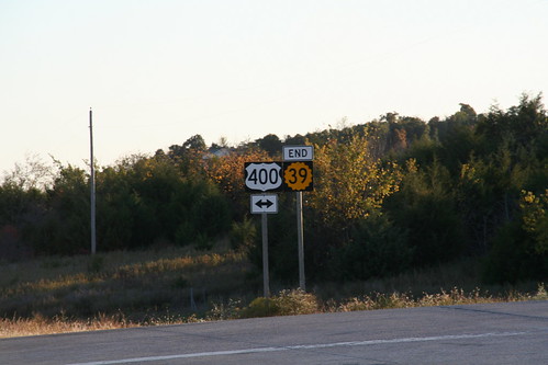
The west end of K-39 at US 400 in Wilson County. 20 October 2006
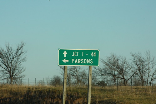
The destination guide sign on eastbound US 166 at the junction with US 400 east of Baxter Springs uses the Junction with I-44 for the destination on eastbound US 166/400, and Parsons for westbound US 400.
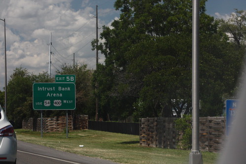
The guide sign for the Intrust Bank arena on Northbound I-135 directs traffic onto westbound Kellogg. The US 54 and US 400 shields on this sign has a inset border. 20 July 2012
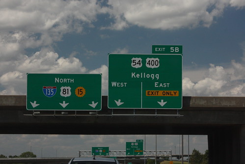
The advance guide sign for the interchange between I-135 and Kellogg (US 54-400) is a two-lane exit with an optional lane. On the reassurance assembly, US 81 and K-15 are both posted. On the exit guide sign, Kellogg Avenue is posted as 'Just Plain Kellogg.' 20 July 2013
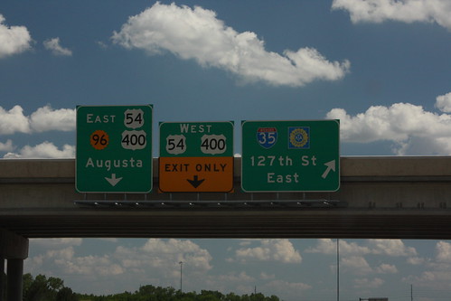
The exit guide sign for the K-96 exit with I-35 and 127th Street East (That is the full name of the road). The advance guide signs for the southeast end of the freeway at US 54-400 are a bit cramped... These signs pre-date the addition of US 400. 20 July 2013