
South Endpoint:
North Endpoint:
Counties Passed through: Labette, Neosho, Allen, Anderson, Franklin, Douglas, Jefferson, Atchison
History
Average Annual Daily Traffic
Junction Guide
Photos
Clicking on a photograph takes you to the photo's flickr page
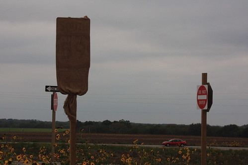
Here's a shot of some of the new signs installed along the County Road 460 at the new US 59 interchange. Note that the one of the two assemblies has a set of "One Way" signs, but the other post does not have them installed. 15 September 2012
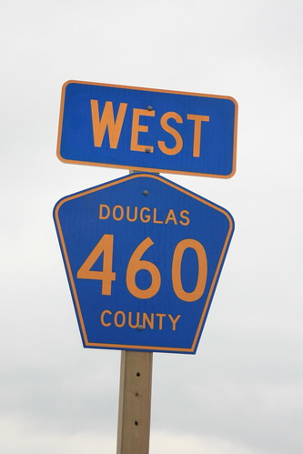
Just past the new US 59 interchange, KDOT installed new County Road 460 markers, including the direction of travel on the sign. Of note, the border on the direction sign is along the edge of the sign, while the border on the CR 460 marker is inset. For County road markers, the 2009 MUTCD specifies the border on the edge. 15 September 2012
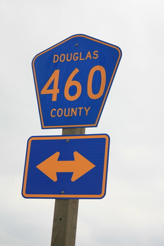
The sign for County Road 460 at the end of the off-ramp from the new US 59. Note that both the arrows and the CR-460 marker both have the (incorrect) inset border. 15 September 2012
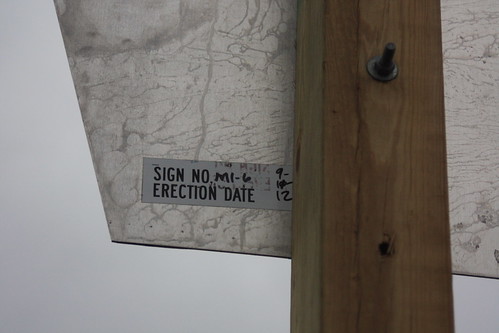
The back of one of the directional assemblies on County Road 460 at the new US 59 has a installation sticker indicating that the sign was installed on Sept. 11, 2012. "M1-6" is the MUTCD code for a county road marker 15 September 2012
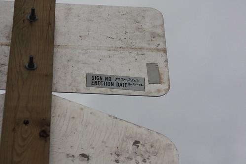
Here is the back of the direction marker on County Road 460 at the junction with the new US 59 freeway. "M3-2" indicates that this is a Eastbound directional marker. The "(c)" presumably indicates that this is the back of a county road marker. 15 September 2012