
South Endpoint:
North Endpoint:
Counties Passed through: Labette, Neosho, Allen, Anderson, Franklin, Douglas, Jefferson, Atchison
History
Average Annual Daily Traffic
Junction Guide
Photos
Clicking on a photograph takes you to the photo's flickr page
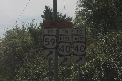
A major reconstruction of the 6th and Iowa intersection in Lawrence has changed access patters for traffic coming off of the Turnpike. All traffic must take Rockledge Road to get to 6th or Iowa. This assembly has been modified by having the "straight ahead" arrows replaced with "exit right" arrows. Since Rockledge is the designated route for traffic from the Turnpike to westbound 6th Street, there is no detour sign above the "To West 40" assembly. 19 May 2014
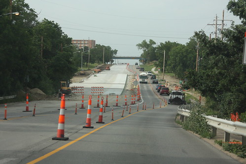
One of many summer features in Lawrence for 2014 is the reconstruction of the intersection of 23rd and Iowa. While there are two lanes on westbound 23rd (K-10, eastbound Clinton Parkway, as well as Iowa Street (US 59) are down to one lane. 14 June 2014
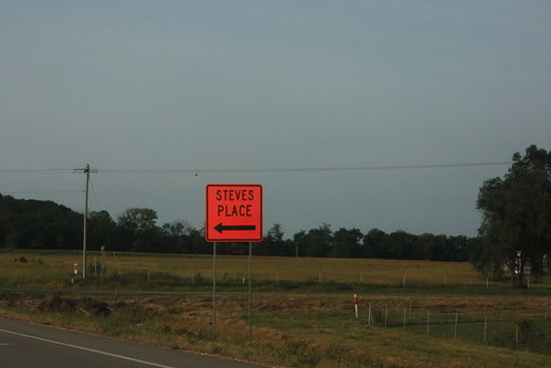
Because the construction of the South Lawrence Trafficway has closed the main route to Steve's Place (a reception venue), Steve managed to get KDOT to post orange guide signs, including this one on US 59 at N 1100 Road, directing people heading for the venue. 14 June 2014
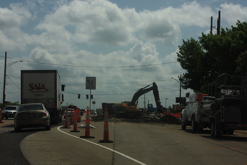
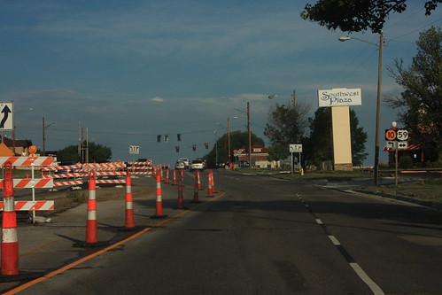
Construction is underway at the intersection of 23rd and Iowa in Lawrence. The southwest quadrant of the intersection is undergoing a full-depth rebuilding. As a result, eastbound Clinton Parkway is reduced to one lane adjacent to the westbound lanes, and there's a posted no right turn onto southbound Iowa. 16 June 2014