
South Endpoint:
North Endpoint:
Counties Passed through: Labette, Neosho, Allen, Anderson, Franklin, Douglas, Jefferson, Atchison
History
Average Annual Daily Traffic
Junction Guide
Photos
Clicking on a photograph takes you to the photo's flickr page
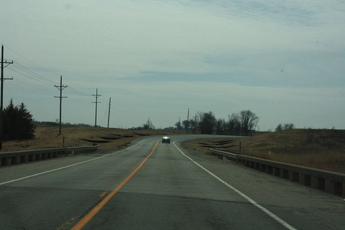
Here we have the grading for the interim connection between the old 2-lane and the new freeway on US 59 in Franklin County. 14 March 2009
At the junction with Stratford Road, the old two lane has been shifted to the west slightly to allow for an interchange on the new US 59 freeway. 14 March 2009
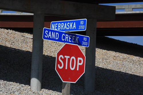
The sign on Nebraska road that was upside down has been replaced with a new sign that is right side up on both sides. Nebraska Road was re-aligned, and the new signs installed, as part of constructing the new US 59 in Franklin County. The bridges in the background take the new 59 over Sand Creek Road.

This sign for I-70 near the intersection of 6th and Iowa has an east marker, a leftover from when the ramps to and from westbound I-70 were closed.
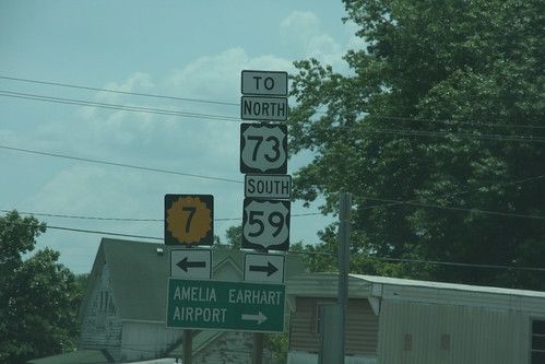
At the corner of 17th and Main, K-7 officially turns east, however,
for northbound US 73 or Southbound
US 59, traffic is encouraged to turn west.