
Length: 243.57 miles
South Endpoint:
North Endpoint:
Counties Passed through: Cherokee, Crawford, Bourbon, Linn, Miami, Johnson, Wyandotte, Leavenworth, Atchison, Doniphan
Full Description
History
Average Annual Daily Traffic
Junction Guide
Photos
Clicking on a photograph takes you to the photo's flickr page
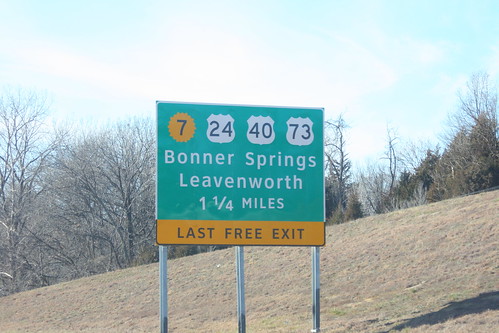
One of the approach signs for the I-70/Kansas Turnpike Bonner Springs exit got damaged and had to be replaced. The replacement sign uses the Clearview typeface, and the K-7 shield is the 20-petal variant generally used only by the KTA. 22 December 2012
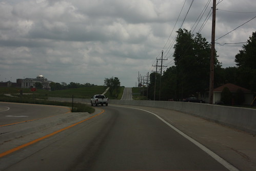
The onramp from 20th Street to K-7/US 73 on the north side of Leavenworth runs along the alignment of Metropolitan Avenue. Obviously, Metropolitan has been re-aligned, but the new alignment is fairly close to the on-ramps. 26 May 2013
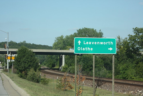
Should you attempt to turn right to head toward Olathe, you'll wind up stuck on the tracks... or in the Kansas River. The ramp from K-32 to southbound K-7 is to the left. 31 July 2012
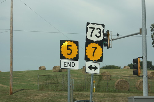
The Northwest end of K-5 at US 73/K-7 along the Lansing/Leavenworth city limits. 29 August 2013
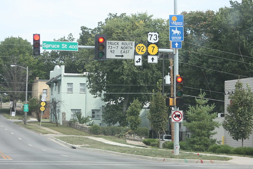
A "No Trucks" sign is posted on the northbound signal at 4th and Spruce in Leavenworth. This marks the south junction of US 73/K-7 and K-92, along with the south end of the truck route along 3rd Street. 29 August 2013