
West Endpoint:
East Endpoint:
Counties Passed through: Sherman, Thomas, Logan, Gove, Trego, Ellis, Russell, Lincoln, Ellsworth, Saline, Dickinson, Geary, Riley, Wabaunsee, Shawnee, Douglas, Leavenworth, Wyandotte
History
Junction Guide
Photos
Clicking on a photograph takes you to the photo's flickr page
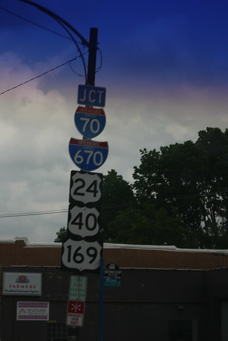
Here we have *five* markers on this junction assembly. In close order, Central Avenue intersects with both I-70 and I-670. In addition, I-70 carries US 24, US 40, and US 169 along this stretch. 26 May 2013
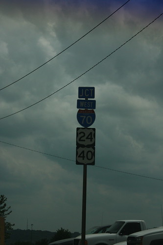
The interchange between I-70/US 24/US 40 and the 7th Street trafficway is an incomplete one. There is no access from southbound 7th/US 69 to eastbound I-70, as this sign indicates, nor is there access from westbound I-70 to northbound 7th. 26 May 2013
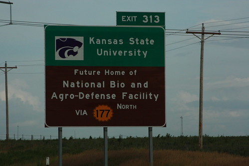
The first of two shots for Kansas State University on I-70 at the K-177 exit. The first is for the future National Bio and Agro-Defense facility (politics willing) The sign also features a double border around the K-177 shield. 20 July 2013
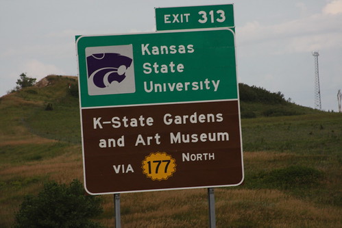
The second Kansas State attraction advertised on I-70 at the K-177 exit is the K-State Gardens and Art Museum. Like the first sign, the second sign also features a double-border on the K-177 shield. 20 July 2013
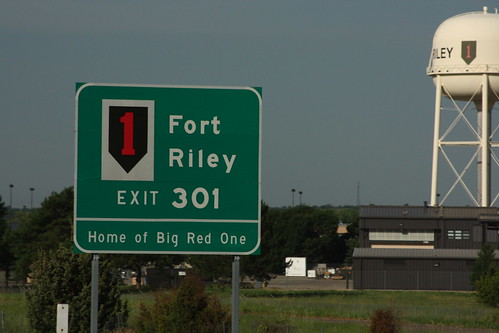
Fort Riley is home to the US Army's first infantry division, AKA, the "Big Red One." The guide sign on I-70 features a red-on-black version of the First Division's insignia. There's also a red-on-green version on the water tower facing the highway. 20 July 2013