
West Endpoint:
East Endpoint:
Counties Passed through: Sherman, Thomas, Logan, Gove, Trego, Ellis, Russell, Lincoln, Ellsworth, Saline, Dickinson, Geary, Riley, Wabaunsee, Shawnee, Douglas, Leavenworth, Wyandotte
History
Junction Guide
Photos
Clicking on a photograph takes you to the photo's flickr page
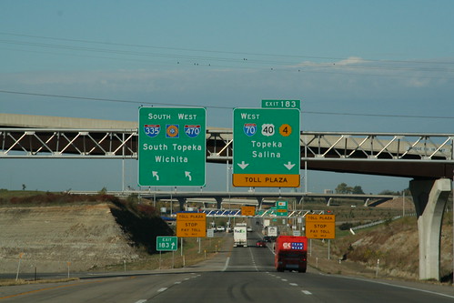
The signage for the departure of I-70 at the East Topeka interchange references I-470 as well as I-335, which begins at the South Topeka interchange. 20 October 2006
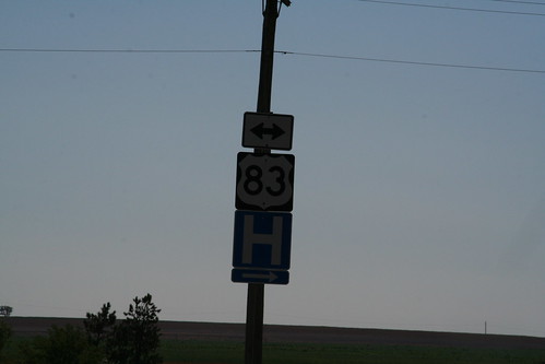
On US 83 at the I-70 interchange northwest of Oakley, the double-arrow marker is mounted above the highway sign. 14 July 2007
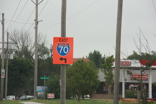
These signs have been placed on the approaches to the West Lawrence Interchange on the Kansas Turnpike (I-70) to remind drivers that the interchange is open to eastbound traffic, but directs westbound customers to East Lawrence or Lecompton. This sign was located on eastbound 6th Street (US 40 near the turnoff for the West Lawrence exit at Rockledge Road. 31 July 2008
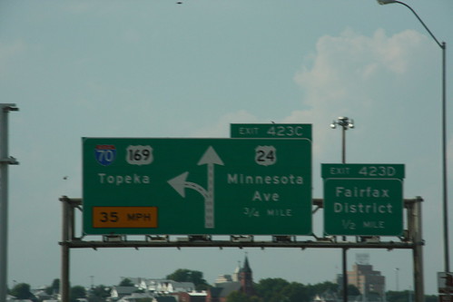
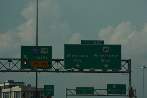
The ramp off of the intercity onto the I-70 mainline is a sharp curve for a freeway. 35 MPH is the design speed. 20 September 2008
Links:US 24, US 169
If the first sign didn't catch your attention regarding this 35 MPH curve on I-70 coming off of the Lewis and Clark viaduct, than maybe the alternating yellow lights will grab your attention. 20 September 2008
Links:US 24, US 169