
West Endpoint:
East Endpoint:
Counties Passed through: Sherman, Thomas, Logan, Gove, Trego, Ellis, Russell, Lincoln, Ellsworth, Saline, Dickinson, Geary, Riley, Wabaunsee, Shawnee, Douglas, Leavenworth, Wyandotte
History
Junction Guide
Photos
Clicking on a photograph takes you to the photo's flickr page

The optional lane sign on 110th Street at I-70/ with the new guide sign that includes US 24/40, in the "normal" configuration. During race weekends at Kansas Speedway, the optional lane is designated for exiting traffic only. 10 March 2009
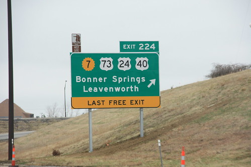
The new advance sign for the K-7 Bonner Springs exit on I-70. The new sign includes US 73 and the re-routed US 24/40. 10 March 2009
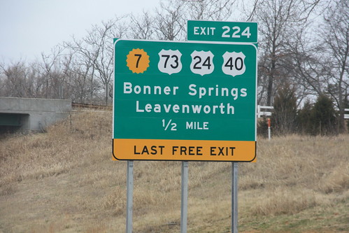
Here's the final sign for the K-7/US 24/40/73 Bonner Springs interchange on I-70. The "Last Free Exit" sign, which was tacked on the old sign with a supplemental sign, features a little more prominently here. 10 March 2009

This sign for I-70 near the intersection of 6th and Iowa has an east marker, a leftover from when the ramps to and from westbound I-70 were closed.
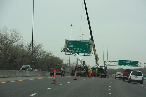
A new BGS is installed on I-70 near I-635> in KCK. The new sign reflects the fact that the Turner Diagonal no longer carries US 40. 1 April 2009