
West Endpoint:
East Endpoint:
Counties Passed through: Sherman, Thomas, Logan, Gove, Trego, Ellis, Russell, Lincoln, Ellsworth, Saline, Dickinson, Geary, Riley, Wabaunsee, Shawnee, Douglas, Leavenworth, Wyandotte
History
Junction Guide
Photos
Clicking on a photograph takes you to the photo's flickr page
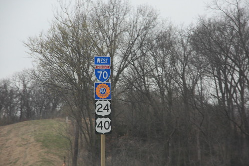
The new Turnpike logo signs have arrived and the old signs have been pulled on I-70/US 24/US 40 in Kansas City. The new turnpike emblems have a 16-petal shield. 1 April 2009
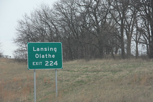
Among the new signs on I-70 in KCK is this brand new set with additional nearby destinations along K-7. 1 April 2009
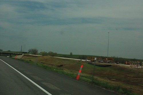
Here we have progress on the eastbound off ramp from the Kansas Turnpike onto 222nd Street. 28 April 2009
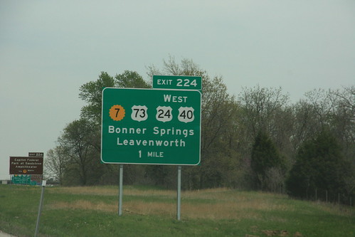
Here's the new eastbound sign for the Bonner Springs interchange on I-70 at K-7, showing the new alignment of US 24-40 and the new south end of US 73. 28 April 2009
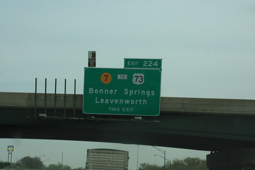
The last bastion of the "old" signs for the Bonner Springs Interchange on I-70 is on the K-7 bridge over the turnpike, facing eastbound traffic. This sign would eventually be replaced, on the new sign, "THIS EXIT" is replaced by a upward pointing arrow. Prior to the changes that necessitated replacement of this sign, US 73 left K-7 at State Avenue, hence the "TO" banner. 28 April 2009