
South Endpoint:
North Endpoint:
Counties Passed through: Sumner, Sedgwick, Harvey, McPherson, Saline, Ottawa, Cloud, Republic
Photos
Clicking on a photograph takes you to the photo's flickr page
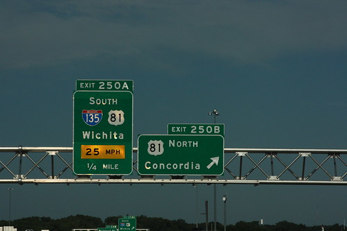
First of Two: The guide signs for the exit from westbound I-70 to Southbound I-135/US 81 warns of the 25 MPH advisory speed on the cloverleaf loop ramp. 20 July 2013
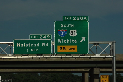
Second of Two: The guide signs for the exit from westbound I-70 to Southbound I-135/US 81 warns of the 25 MPH advisory speed on the cloverleaf loop ramp. Also, the reassurance marker for westbound I-70 has been replaced by the advance guide sign for the next exit west. 20 July 2013
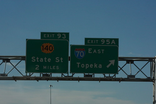
Unlike I-70, the guide signs on I-135/US 81 do *not* have the advisory speed for the loop ramps posted on the guide signs. This assembly, just before the exit ramp from southbound I-135 to eastbound I-70, also has the first advance guide sign for State Street/K-140. 20 July 2013
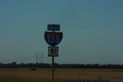
This reassurance marker on I-135/US 81 on the south end of McPherson features a ugly "straight out of Microsoft" typeface for the I-135 shield. 20 July 2013
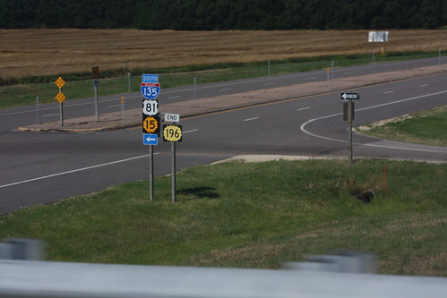
The west end on K-196 at I-135/US 81/K-15 in southern Harvey County. 20 July 2013