
Length: 36.611 miles
West Endpoint:
Junction US 40, 6th and Iowa Street, Lawrence (1956-1996)
I-70/Kansas Turnpike Exit 197 northwest of Lawrence (1996-)
East Endpoint:
I-435 exit 1B (de facto)/I-35 exit 222 (de jure) in Lenexa (1984-)
Counties Passed through: Dickinson, Morris, Wabaunsee, Shawnee, Jefferson, Douglas, Johnson, Wyandotte
Full Description
History
Average Annual Daily Traffic
Junction Guide
Photos
Clicking on a photograph takes you to the photo's flickr page

The Bridge over the Wakarusa River on County Road 442 (old K-10) just west of Eudora. It was torn down and replaced in 1998. 12 June 1995

Some progress on the realignment of US 40 at the intersection with the South Lawrence Trafficway (K-10). This shows the completed bridge to the right, as well as some asphalt for the new 40. 3 September 1995

A partially paved South Lawrence Trafficway (K-10) sweeps over Clinton Parkway. 1 June 1996
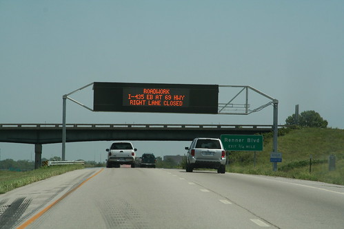
The KC Scout system uses several variable message boards. Today, the one on K-10 at Ridgeview Road in Johnson County notifies travelers of construction. 9 August 2006
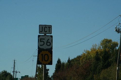
On the westbound approach of I-435 to I-35, there is a junction sign for US 56 (which is a rider to I-35) and K-10 (which begins a mile ahead) 13 October 2006