
South Endpoint:
North Endpoint:
Counties Passed through: Sumner, Sedgwick, Butler, Chase, Lyon, Coffey, Osage, Franklin, Miami, Johnson, Wyandotte
History
Junction Guide
Photos
Clicking on a photograph takes you to the photo's flickr page
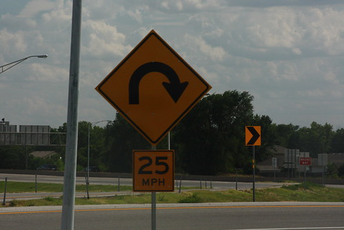
A "hairpin turn" sign is used to warn of the relatively sharp loop ramp onto northbound I-35 at South Wichita. 20 July 2013
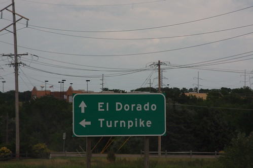
This guide sign on the eastbound K-254 approach to the Kansas Turnpike at El Dorado uses "Turnpike" in lieu of a control city. 20 July 2013
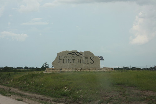
Engraved Stone "Welcome to the Flint Hills" signs have been posted where I-35 and I-70 enter the flint hills. This is the northbound entrance on I-35 northeast of El Dorado. 20 July 2013
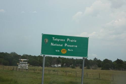
This sign on the Kansas Turnpike is just wrong on so many levels. The margins are poor. The initial letters on each word are clearly larger than the rest of the letters, "North" should be in all caps (the larger "N" here is correct.) To top it off, since this sign is advising of a recreational area, it should be brown, not green. I don't mind the inset border on the K-177 shield, though. 20 July 2013
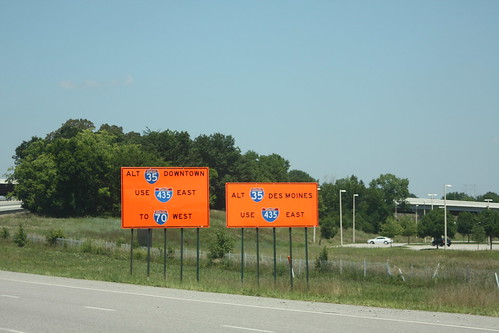
Because of construction on I-35 just past the state line, travelers along the major highways leading into I-35 are shown these orange signs encouraging travelers to go around Kansas City on I-435 instead. This set is on US 69 at the 435 junction. 10 August 2013