
South Endpoint:
North Endpoint:
Counties Passed through: Sumner, Sedgwick, Butler, Chase, Lyon, Coffey, Osage, Franklin, Miami, Johnson, Wyandotte
History
Junction Guide
Photos
Clicking on a photograph takes you to the photo's flickr page
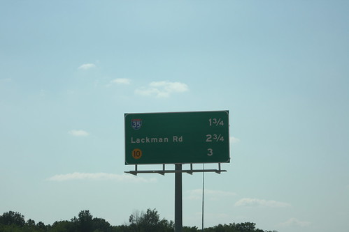
With the new ramp from westbound I-435 to Quivira located just west of the US 69 junction, this westbound distance sign has been changed. The next three exits are I-35, Lackman, and K-10. 10 August 2013
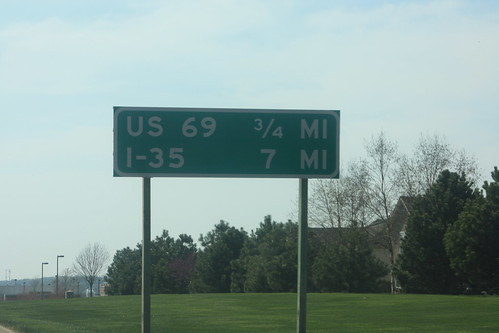
For some reason, this guide sign, indicating directions to US 69 and I-35, is located on 135th Street just west of Nall. This distance sign, in a unusual move, explicitly states the unit of measurment. Based on the style and the orange sticker on the back, the sign dates back to when 135th was K-150. 19 April 2014
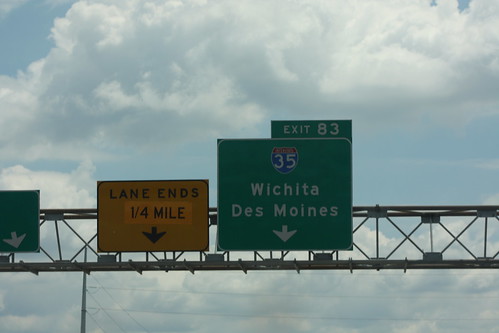
First of Two: as part of current construction of the Johnson County Gateway project, the right lane on eastbound I-435 has been closed about a quarter of a mile before it normally drops off at the I-35 interchange. The "Lane Ends" sign has been overlaid, with "1/4 mile" replacing "1/2 mile." The contractor who applied the overlay did a sloppy job. 25 June 2014
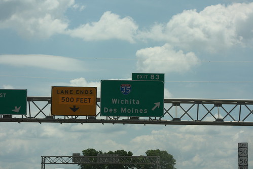
Second of Two: as part of current construction of the Johnson County Gateway project, the right lane on eastbound I-435 has been closed about a quarter of a mile before it normally drops off at the I-35 interchange. The "Lane Ends" sign has been overlaid, with "500 Feet" replacing "1/4 mile." The contractor who applied the overlay did so in a clearly haphazard way. 25 June 2014
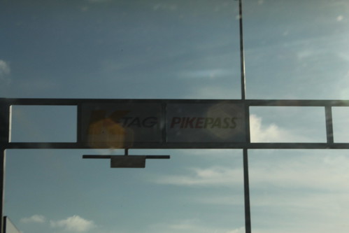
The K-TAG gantry at the Emporia Interchange on the Kansas Turnpike (where I-35 leaves the Turnpike) features the logos of both Kansas's K-TAG and Oklahoma's PikePass. 26 February 2015