
Length: 397 miles
West Endpoint:
East Endpoint:
Counties Passed through: Cheyenne, Rawlins, Sheridan, Thomas, Decatur, Norton, Phillips, Smith, Jewell, Republic, Washington, Marshall, Nemaha, Brown, Doniphan
History
West Endpoint:
Colorado State Line west of St. Francis
East Endpoint:
Missouri State Line near Elwood
Counties Passed through: Cheyenne, Rawlins, Sheridan, Thomas, Decatur, Norton, Phillips, Smith, Jewell, Republic, Washington, Marshall, Nemaha, Brown, Doniphan
History
Photos
Clicking on a photograph takes you to the photo's flickr page
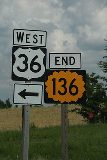
The North end of K-136 at US 36 north of Troy.
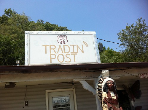
The sign for the highway 36 Tradin' Post in Wathena has a very well hand-drawn version of a US 36 cutout shield. 26 June 2012
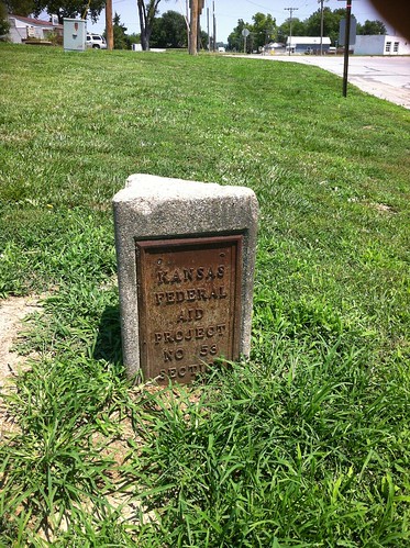
I also found a old Concrete "Federal Aid Project" Marker along US 36 at St Joseph Street in Wathena 26 June 2012
The southbound advance guide signs on I-135 for K-61 on the south end of McPherson feature the K-61 shield, but not one for US 81B, which has its south end at the K-61 interchange. 20 July 2013