
Length: 370.10 miles
West Endpoint:
East Endpoint:
Junction US 59 Southeast of Nortonville (1995-present)
Counties Passed through: Scott, Lane, Ness, Rush, Barton, Rice, Ellsworth, McPherson, Saline, Dickinson, Morris, Wabaunsee, Shawnee, Jefferson, Atchison
Full Description
History
Average Annual Daily Traffic
Junction Guide
Photos
Clicking on a photograph takes you to the photo's flickr page
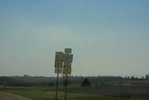
The junction assembly for US 159/K-4A on southbound US 59 near Nortonville also features a reassurance marker for westbound K-4, which begins just past the US 159 junction. 25 March 2012
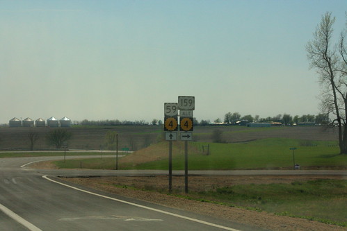
Here's the guide assembly directing southbound `US 59 traffic at the US 159/K-4A junction. Technically, there should be a "TO" marker between the US 59 and K-4 markers. 25 March 2012

A new recreational guide sign has been installed along I-70 for the Native Stone Scenic Byway, which goes along K-4 in Shawnee and Wabaunsee counties. The new sign features a inset black border on the K-4 shield. 4 May 2012
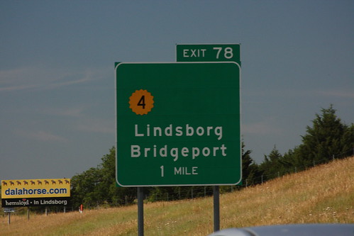
The southbound exit guide signs for the south junction between I-135 and K-4 in Saline County north of Lindsborg has had its US 81B shield removed, but the K-4 shield has not been moved to re-balance the sign. The northbound signs did not have a US 81B shield. 20 July 2012
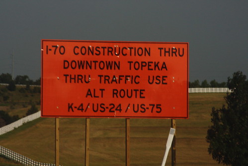
Because of major construction on the I-70 Polk Quincy viaduct, traffic is advised via this big orange sign to go around using K-4 north to US 24 west to US 75 south. 11 July 2014