
December 5, 1994
Length: 454.9 miles
West Endpoint:
East Endpoint:
Counties Passed through: Hamilton, Kearney, Finney, Gray, Ford, Kiowa, Pratt, Kingman, Sedgwick, Butler, Greenwood, Wilson, Neosho, Montgomery, Labette, Cherokee
Length: 454.9 miles
West Endpoint:
Colorado State Line west of Coolidge
East Endpoint:
Missouri State Line Baxter Springs
Counties Passed through: Hamilton, Kearney, Finney, Gray, Ford, Kiowa, Pratt, Kingman, Sedgwick, Butler, Greenwood, Wilson, Neosho, Montgomery, Labette, Cherokee
Photos
Clicking on a photograph takes you to the photo's flickr page
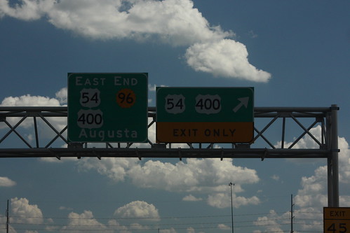
The east end of K-96 at Kellogg on the east side of Wichita. The signage pre-dates the introduction of US 400 and the truncation of K-96. Therefore, the signs are a bit crammed. 20 July 2013
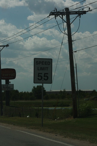
Here is a speed limit sign on Kellogg (US 54-400) using a non-standard typeface. 20 July 2013
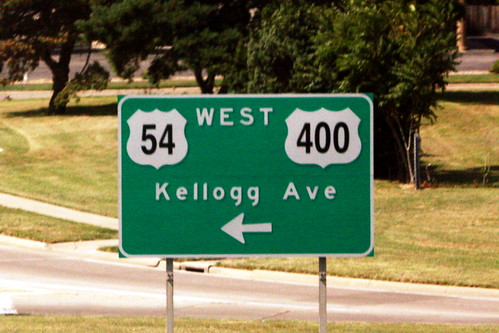
This guide sign for US 54/400 at Hillside has oversized highway shields with a typeface "Straight outta Microsoft." Note, also, that instead of a control city, the guide sign uses the roadway name. 20 July 2013