
Length: 28.026 miles
South Endpoint:
North Endpoint:
Counties Passed through: Johnson, Wyandotte
Junction Guide
South Endpoint:
Missouri State Line in Leawood
North Endpoint:
Missouri State Line on the Missouri River north of Kansas City
Counties Passed through: Johnson, Wyandotte
Junction Guide
Photos
Clicking on a photograph takes you to the photo's flickr page
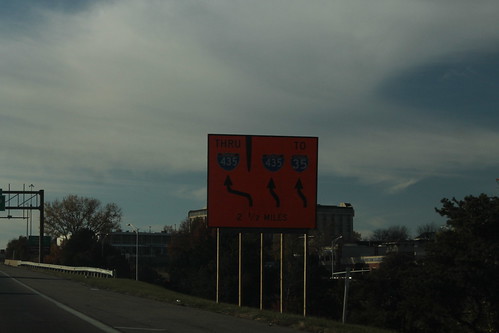
On I-435 between 69 and I-435, there is a shift in the traffic pattern. The left lane is crossed over into the westbound lanes, becoming a de facto express lane. 8 November 2014
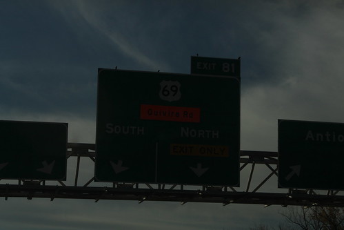
The ramp from I-435 to Quivira Road has been closed. The Detour is to take the US 69 exit and take the Collector-Distributor road to the Quivira ramp. 8 November 2014