
Original Kansas Highway
Length: 243.57 miles
South Endpoint:
North Endpoint:
Counties Passed through: Cherokee, Crawford, Bourbon, Linn, Miami, Johnson, Wyandotte, Leavenworth, Atchison, Doniphan
Full Description
History
Average Annual Daily Traffic
Junction Guide
Length: 243.57 miles
South Endpoint:
Oklahoma State Line, north of Picher, Oklahoma (concurrent with US 69)
North Endpoint:
Nebraska State Line north of White Cloud
Counties Passed through: Cherokee, Crawford, Bourbon, Linn, Miami, Johnson, Wyandotte, Leavenworth, Atchison, Doniphan
Full Description
History
Average Annual Daily Traffic
Junction Guide
Photos
Clicking on a photograph takes you to the photo's flickr page
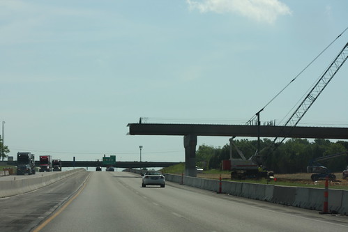
The new bridge taking the ramp from K-7 to westbound I-70 is in progress. The beams are in place up to the eastbound lanes of I-70. 25 June 2014