Length: 169 miles
West Endpoint:
East Endpoint:
Counties Passed through: Sumner, Cowley, Chautauqua, Montgomery, Labette, Cherokee
Photos
Clicking on a photograph takes you to the photo's flickr page
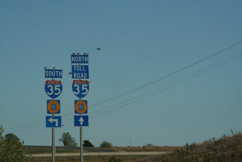
The US 166 interchange with I-35 in Sumner County complete with the Turnpike logo. The "Toll Road" sign reminds all that the Southern Terminal is located north of this interchange... travel south to Oklahoma is free from here. 20 October 2006
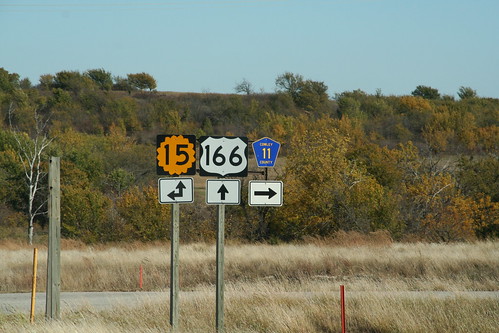
The west Junction of K-15 and US 166 in Cowley County. Note that the Cowley CR 11 sign appears to have been added as an afterthought. 20 October 2006
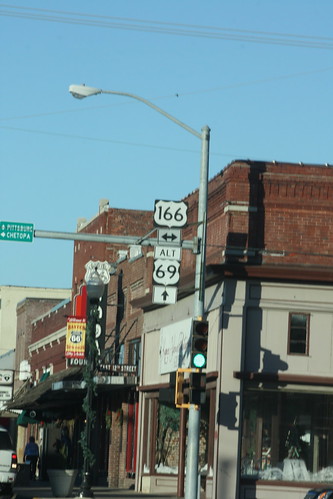
At the junction of US 69A with US 166 in Baxter Springs, the route marker assembly is posted on the traffic signal. In addition, the destination guide assembly is also on the traffic signal. 13 December 2012
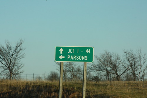
The destination guide sign on eastbound US 166 at the junction with US 400 east of Baxter Springs uses the Junction with I-44 for the destination on eastbound US 166/400, and Parsons for westbound US 400.