West Endpoint: Colorado state line west of Weskan
East Endpoint: Junction US 40/US 40N, Manhattan
Counties Served:
Wallace, Logan, Gove, Trego, Ellis, Russell, Ellsworth, Saline, Dickinson, Geary, Riley
History
From the border, 40S traveled along the Victory Highway (Also known as the Golden Belt) through Oakley, WaKenney, Hays, Elsworth, Salina, and Abilene before reaching the east end of the Midland Trail at Manhattan. East of Manhattan, the Golden Belt continued east as US 40.
The Golden Belt between Junction City and the west end of Fort Riley has the distinction of being the first segment to be let – the bids for this project were opened on July 24, 1918 and construction of the brick-paving project was completed by the end of 1919. By 1926, the Golden Belt was mostly paved between Fort Riley and Abilene and mostly gravel or dirt west of Abilene.
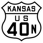
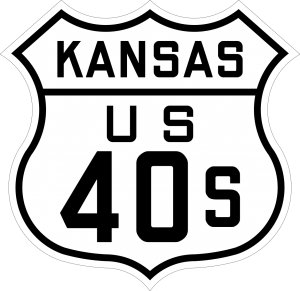
The original US highway numbering plan called for the Golden Belt to be designated US 340 and the Midland Trail to be designated US 40. The towns along the Golden Belt protested, claiming that the Midland Trail received the US 40 designation because it passed through the Highway Commissioner’s hometown. A meeting was held with the Victory Highway cities on December 18, 1925, resulting in a compromise in which the Midland Trail became US 40N, while the Golden Belt became US 40S.
US 40S from Manhattan to Fort Riley, and from Abilene to Salina, was paved by 1930. As the War Department was likely responsible for the roadway through Fort Riley, I do not know when the road was paved through the fort. If it were paved by 1930, that would mean that US 40S would have been paved from Manhattan west to Salina.
US 40S was redesignated as US 40 in 1936 when US 40N was redesignated as an extension of US 24.
Timeline
- 1919: Golden Belt brick paved from Junction City to Fort Riley. This was the first Federal-Aid contract let by the State Highway Commission.
- 1921:
- Golden Belt paved from Buckeye Avenue in Abilene to Detroit
- Golden Belt paved along the Dickinson/Geary County Line.
- 1922: Golden Belt paved from Dickinson/Geary County Line east to Junction City.
- 1923: Golden Belt paved from Detroit to Chapman.
- 1924: Golden Belt paved from Chapman to the Dickinson/Geary County line, completing a paved route from Abiline to Fort Riley.
- 1926: Victory Highway graded from Russell east 9 miles.
- 1927:
- Graded from 1 1/2 miles west of the Trego/Ellis county line to Ellis.
- Graded from the Ellis/Russell county line to 1 mile east of Gorham.
- Graded from 9 miles east of Russell to Dorrance. Golden Belt is bricked from Manhattan southwest ~1 mile.
- 1928:
- Graveled from the Colorado state line to Wallace
- Graveled from K-25 to 1 1/2 miles west of the Trego/Ellis county line
- Graded from Ellis to the Ellis/Russell county line
- Graveled from the Ellis/Russell County line to ~ 1 1/2 miles west of Russell
- Graded from Dorrance to Wilson
- Graded from 1 1/2 miles west of Carneiro to the Ellsworth/Saline county line.
- Graveled from the west city limits of Solomon to Willow Street in Solomon.
- Mostly paved from Eureka Lake Southwest to Fort Riley.
- 1929:
- Graveled from Wallace east to K-25
- Graveled from 1 1/2 miles west of the Trego/Ellis county line to the Ellis/Russell county line, including a new alignment and two bridges over Big Creek near Yocemento
- Graveled from Russell to the north junction with K-14 near Ellsworth.
- Gaps in pavement between Eureka Lake and Ogden filled.
- 1930:
- Blacktopped in Trego County.
- Graveled from the north junction with K-14 near Ellsworth east 4 miles.
- Paved from Bavaria, through Salina, to Abilene.
- Paved between Eureka Lake and the end of brick road southwest of Manhattan
- US 40S now paved between Salina and Manhattan.
- 1931:
- Blacktopped from the Colorado State Line to Sharon Springs
- Blacktopped from Grainfield to the Gove/Trego county line.
- Paved between Hays and Victoria
- Paved from the west end of Russell east ~ 3.3 miles
- Paved from the Russell/Ellsworth county line east to 2 miles east of Wilson
- Paved from the north junction with K-14 east 4 miles
- Paved from 1/2 mile west of the Ellsworth/Saline county line to Bavaria.
- New paved alignment on three curves in eastern Dickinson and western Geary counties.
- 1932:
- Blacktopped from the Trego/Ellis County Line to Hays.
- Paved from 4 miles east of Ellsworth to 1/2 mile west of the Ellsworth/Saline county line, with a partial realignment.
- 1933:
- New alignment graded from 2 miles east of Wilson to K-14, with a railroad underpass 4 miles east of Wilson.
- 1934:
- Paved on a 0.2-mile section in Dorrance
- Paved from 2 miles west of Willson to 6 miles west of Ellsworth
- 1935:
- Paved with concrete and brick in Ellis. Paved from Adams Street to Pine Street in Wakeeney
- Paved from 6 miles west of Ellsworth to K-14.
- 1936: US 40S re-designated US 40