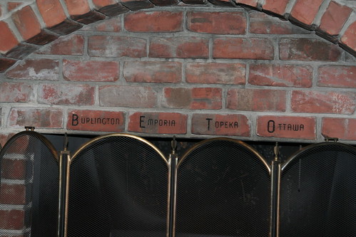
Beto Junction is an intersection in northern Coffey County, Kansas between the towns of Waverly and Lebo. “Beto” stands for the closest major communities: Burlington (16 miles south), Emporia (25 miles west), Topeka (45 miles north), and Ottawa (30 miles northeast)
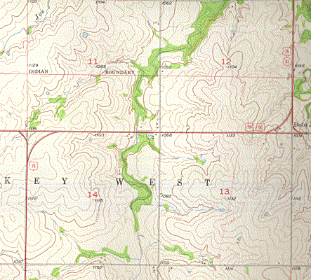
On the above topographic map. Beto Junction is labeled at the intersection of US 50, US 75, and K-31. 75 followed 50 west for about two miles, while 31 followed 50 east toward Waverly.
Originally, US 50S (the predecessor to US 50) came in from the west, then turned south at the location of the west junction with US 75 on the map above, meeting with US 75 one mile south. US 50S and 75 then proceeded east five miles to K-31 and K-33 just west of Waverly. From K-33, US 50S, US 75, and K-31 would turn north through Melvern. The routes would split just southeast of Lyndon, where US 75 and K-31 would turn west and north to Lyndon before heading north to Topeka and Osage City, while US 50S would turn east toward Ottawa.
The “Burlington-Lyndon cut-off” was built under the New Deal and was completed by 1934. The new alignment of US 50S and K-33 would also constructed as a result of the New Deal. By 1936, US 50S would be re-routed onto K-33 from Beto Junction to Ottawa. The former US 50S alignment from Lyndon east would be re-designated as an extension of K-68.
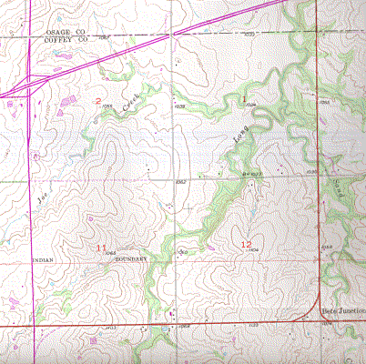
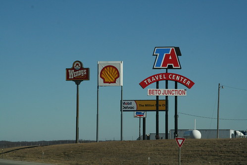
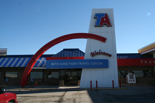
On this “photorevised” USGS topo map, the purple lines show changes to the map since the 1957 edition. As part of the construction of I-35, a new US 75 ‘super two’ highway was constructed from west of Melvern south to I-35, and continuing south to the junction with old US 50. When a new truck stop was constructed at the southeast corner of the I-35/US 75 junction, the truck stop owners noticed the “old” Beto Junction along old US 50 and choose to designate their truck stop as the ‘new’ Beto Junction. Note that the Beto Junction label is still marked on the photoreviseed map at the “old” location.
The new US 75 rejoined the old alignment at the old west junction with US 50, with the intersection changed from a “wye” to a standard four-leg intersection, while old Beto Junction retained its ‘wye.’
Also as a consequence of the construction of I-35, K-31 was re-aligned to bypass Beto Junction. At the north end of the US 75 “super two,” K-31 replaced a spur highway (K-174) east from US 75 to Melvern, then turned south on the original pre-1934 US 75 alignment to I-35, then turn east on I-35 for two miles before turning south toward Waverly, where it returns to its original route toward Garnett.
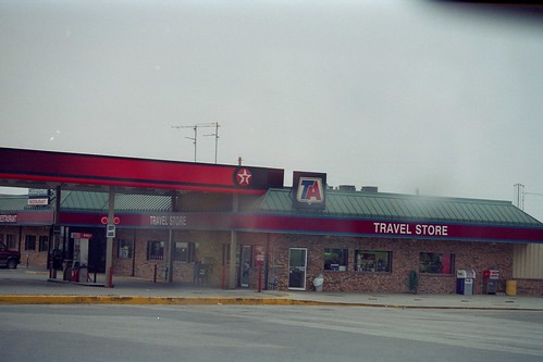
Photos

“Old Beto Junction – the original.” Taken August 18, 2000