
Length: 427.138 miles
West Endpoint:
East Endpoint:
Counties Passed through: Wallace, Logan, Gove, Trego, Ellis, Russell, Lincoln, Ellsworth, Saline, Dickinson, Geary, Riley, Pottawatomie, Wabaunsee, Shawnee, Douglas, Leavenworth, Wyandotte
Full Description
History
Junction Guide
Photos
Clicking on a photograph takes you to the photo's flickr page
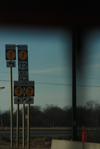
At the ramp from I-70 onto K-7, the replacement markers are posted on much taller poles so that the addition of US 24, US 40, and US 73 are properly included. 14 February 2009
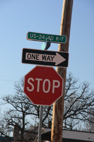
At the junction of Riverview Road and K-7, the new street blades reflect the addition of US 24 and US 40, but US 73 is left out of the picture. 14 February 2009
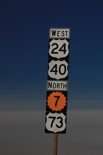
The first reassurance marker on K-7 north of the Bonner Springs exit. US 24 and US 40 take the 'superior' position, while US 73 is relegated to the bottom, below the K-7 marker. 14 February 2009
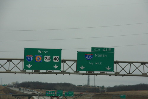
A new guide sign has been added to I-70 that features the addition of US 24 and US 40 to I-70 at I-435. 10 March 2009
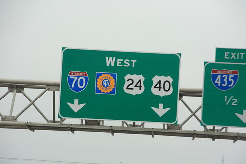
Here's a closeup of the new guide signs on I-70/US 24/US 40 at I-435. The Turnpike logo used on the sign is a 16-petal variant, the same shield shape as the modern Kansas Highway sign. 10 March 2009