
Length: 427.138 miles
West Endpoint:
East Endpoint:
Counties Passed through: Wallace, Logan, Gove, Trego, Ellis, Russell, Lincoln, Ellsworth, Saline, Dickinson, Geary, Riley, Pottawatomie, Wabaunsee, Shawnee, Douglas, Leavenworth, Wyandotte
Full Description
History
Junction Guide
Photos
Clicking on a photograph takes you to the photo's flickr page

This new guide sign for the ramp from K-7 to I-70 features the Turnpike, US 24, and US 40.
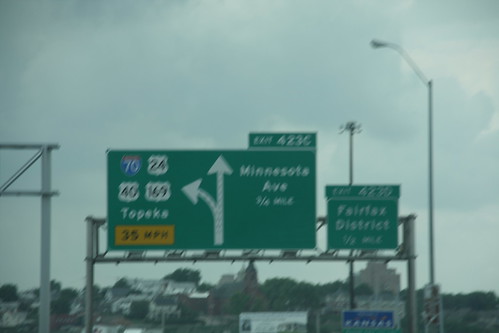
The first of the new signs on I-70 entering Kansas which feature I-70, US 24, US 40, and US 169, plus reflect the removal of Minnesota Avenue from the state highway system. 11 June 2009
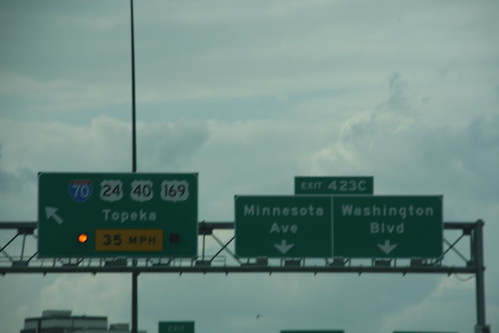
Here is the new signs for the Minnesota Avenue exit. The alternating flashing amber arrows were retained in the new sign for I-70 and US 169. US 40 was added, and US 24 was moved from Minnesota Ave. 11 June 2009
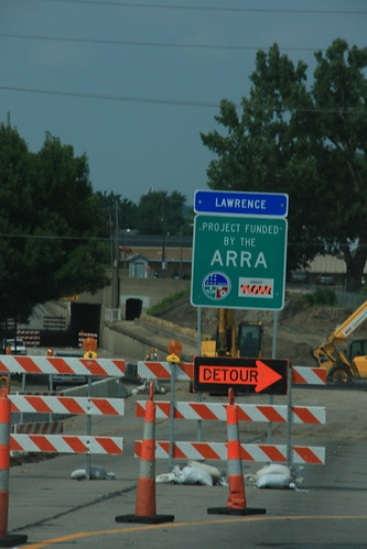
With special financing comes special signage. This sign on North 2nd Street (US 40-59) in Lawrence, just off the Kansas River bridge, advises travelers that your stimulus dollars are at work. 6 August 2009

After a sudden shower, a rainbow appeared over K-7/US 24/US 40/US 73 near Bonner Springs.