
Length: 235.403 miles
South Endpoint:
North Endpoint:
Counties Passed through: Sumner, Sedgwick, Butler, Chase, Lyon, Coffey, Osage, Franklin, Miami, Johnson, Wyandotte
History
Junction Guide
South Endpoint:
Oklahoma State Line South of South Haven
North Endpoint:
Missouri State Line in Kansas City
Counties Passed through: Sumner, Sedgwick, Butler, Chase, Lyon, Coffey, Osage, Franklin, Miami, Johnson, Wyandotte
History
Junction Guide
Photos
Clicking on a photograph takes you to the photo's flickr page

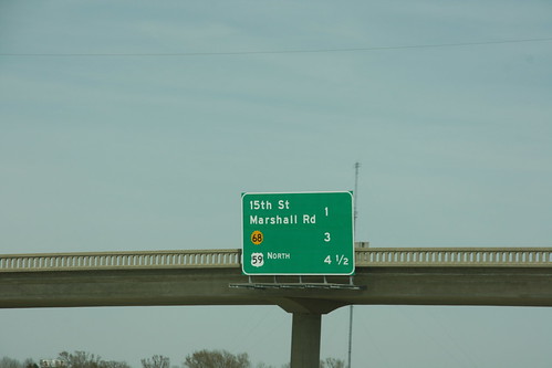
A new BGS on US 59 just northeast of the south junction with US 59 now includes the advance distance to the new US 59 north exit, as well as the 15th Street and K-68 exits.
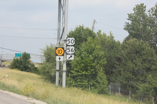
The guide marker on I-435 approaching the I-35 interchange still mentions K-10, US 50, and US 56, but US 169 has now been removed from the assembly. 26 May 2012
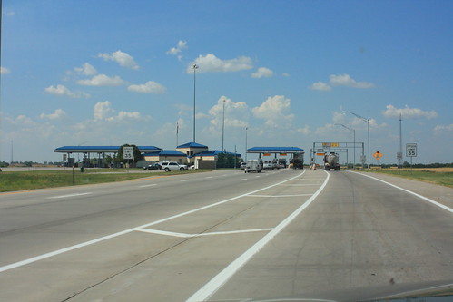
The Southern Terminal on the Kansas Turnpike/I-35 south of Wellington. 4 June 2012